Buckden Pike (702m)
Trig Point: SD 961 788
Walked: 11th May 2010
Walked: 11th May 2010
Stgart / Finish: Buckden, Upper Wharfedale, Yorkshire Dales
Distance: 13 km (8 miles)
Distance: 13 km (8 miles)
Time taken: 4 hours
Weather: Snow showers on the summit, with occasional sunny spells; surprisingly cold, reasonable visibility between the showers.
Height gain: 470 metres
Summit Cairn: 702 metres
Map: OL30
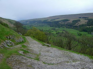
Route: From Buckden, clear track (Buckden Rake) leads up onto shelf of land above Cray (Roman road) before clear path slants steadily up across Buckden Out Moor to reach the summit, with a final short but steep climb. From the summit, our route follows the right-hand side of the wall along the top of the broad summit ridge to reach the RAF war memorial, from where it is a short walk to join Walden Road (bridleway). This grassy path/track leads steadily down above the deep and dramatic ravine of Cam Gill Beck all the way into Starbotton in Wharfedale - this is a superb descent. Delightful riverside path (Dales Way) leads all the way back to Buckden. OL30 map required for this walk.
Photos of the walk
These photos are in order, and the files are named. Copyright Mark Reid 2010


No comments:
Post a Comment